Rainforest Foundation US and If Not Us Then Who release new documentary from the Amazon that shows how indigenous environmental defenders are conserving forests using technology
The Facts
- About 35% of intact forest landscapes in the Amazon are managed by Indigenous communities.
- Yet, in 2018, more than 30 environmental defenders were killed, including several Indigenous leaders.
- The Amazon loses the equivalent of about one soccer field of rainforest every minute.
- Indigenous-led forest monitoring using affordable, high-tech solutions deliver “measurable reductions in deforestation,” according to Columbia University researchers.
- This technology has the potential to be scaled up and deployed to other parts of the Amazon and beyond, resulting in important reductions in deforestation across the tropical belt.
What’s at stake
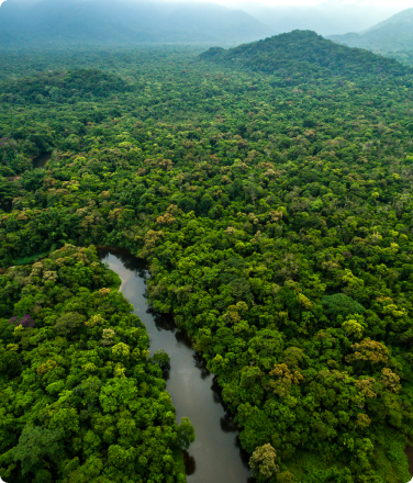
Indigenous communities living across the Amazon have known for centuries how to protect the forest.
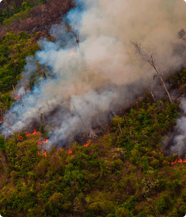
However, intensifying industrial slash and burn agriculture, large-scale cattle ranching, and indiscriminate resource extraction are threats that require new tools and new allies to confront these challenges. About 17% of the Amazon forest has been destroyed over the last 50 years and scientists agree that an additional 3 – 8% deforestation could lead to a tipping point in which up to 60% of the Amazon would lose its tree cover and become a savannah-like landscape.
This change would be catastrophic not just for the Indigenous Peoples but to all of us who depend on the forest’s ability to capture and store carbon and maintain its rich biodiversity.
The Solution: High Tech meets ancestral traditions
Fortunately, satellite imagery, inexpensive remote-controlled drones, and GPS enabled smartphones are making it easier for Indigenous communities to patrol their territories remotely and stop deforestation in the Amazon.
These high tech tools are used to track threats to the forest in near real time, resulting in “measurable reductions in deforestation,” according to Columbia University researchers who recently unveiled the preliminary findings of a year-long randomized controlled trial sponsored by Rainforest Foundation US and the Organization of Indigenous Peoples Eastern Amazon (ORPIO). The study was carried out across 250,000 hectares of Indigenous territories in the Peruvian Amazon.
The preliminary results of the study were presented on September 24th at Ford Foundation where scientists, donors, program managers, and representatives from various Indigenous Communities from Central and South America discussed their work and the challenges they face.
The event also featured an exhibition of images by Laurence Ellis of Indigenous Peoples from the site where the study was conducted in the Peruvian Amazon. Ellis’ photos are featured in the upcoming Fall/Winter 2019 issue of Document.
In a panel moderated by actor and climate activist Alec Baldwin, the discussion centered around the potential this technology-driven solution could have in helping protect Indigenous Peoples and the rest of the Amazon from deforestation.
A system to reduce deforestation
The data gathered and analyzed by Columbia University was generated using a four-prong intervention strategy developed by Rainforest Foundation US, ORPIO, and the World Resources Institute.
How It Works: Turning information into action
1. Indigenous technicians are trained and work in regional hubs to collect and analyze satellite data, which alerts them to possible deforestation.
2. Once a threat has been detected, these Indigenous technicians relay the information to “community forest technology monitors,” who use a smartphone app called Forest Watcher to locate the areas in their territories where deforestation may be occurring.
3. These representatives then go into the field with their team to investigate the area, on foot and using drones, to verify the alert with photographs which the app Forest Watcher then geotags and catalogues.
4. Monitors then report their findings back to their community assembly, the highest authority, which determines as a group whether the deforestation is authorized or unauthorized. If it’s the latter, action is taken—either through internal governance systems or by delivering the findings to the proper authorities.
About the study
Between early 2018 and May 2019, researchers at Columbia University measured the impacts of the program, specifically on governance and deforestation rates. Tara Slough, the principal investigator of the study, announced the preliminary findings during the conference. Slough and her team found that not only did the surveyed communities participate in monitoring at high rates, but their monitoring activities increased and deforestation decreased over time, suggesting that maintaining and scaling such programs is a viable long term solution.
The message is clear: Monitoring with technology reduces deforestation, positively impacts governance, and is in high demand.
Scaling up
In light of this system’s potential to reduce or stop deforestation entirely, the logical question is to ask if this solution can be scaled up, how quickly, and at what cost? Rainforest Foundation US calculated that it costs about $5 to protect a hectare of forest and about $1 to avoid one ton of carbon emissions in the study area. However, these costs could vary based on a number of factors when the technology is scaled and replicated elsewhere.
Nevertheless, at these prices, community monitoring can be an extremely powerful tool to reduce deforestation and avoid carbon emissions. Currently, investment in forest protection accounts for only about 1.5% of the hundreds of millions of dollars allocated to mitigating climate change annually. Rainforest Foundation US and our indigenous partners are determined to deploy this technology to the Indigenous territories that need it most.
Supplemental content
“Estudio evalúa el impacto del monitoreo en bosques tropicales de comunidades indígenas en la Amazonía que emplean tecnología y gobernanza de recursos” (documento en Español en pdf de 4 paginas que explica el estudio).


