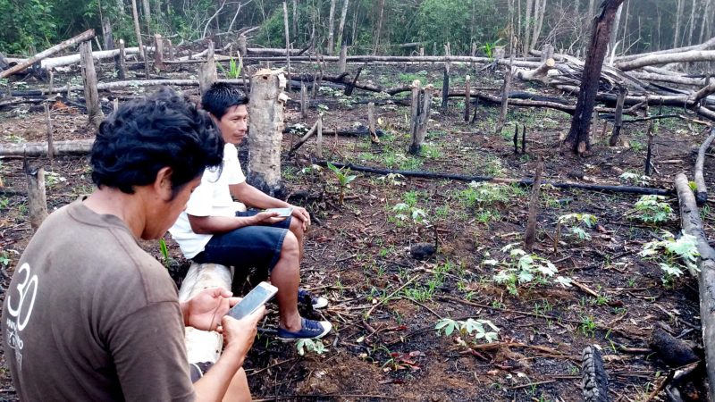
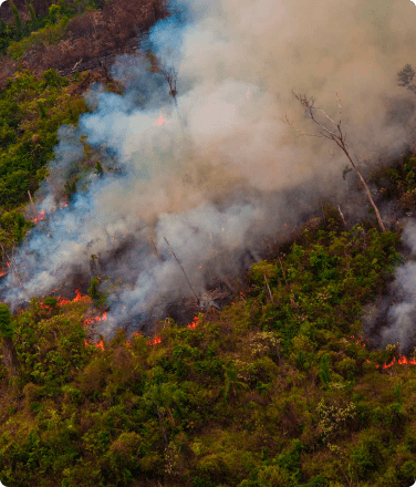
Camila Montoya, a Ticuna forest patroller, investigating and documenting a recently torched area in the Lower Amazon River.
Rainforest Foundation US analysis shows cost-effective reduction in deforestation can be scaled up rapidly
A landmark study shows that indigenous peoples, equipped with little more than smartphones, can be a powerful force in the battle against the Amazon’s destruction.
What did the study find?
A peer-reviewed study, published in a special July issue of Proceedings of the National Academy of Sciences (PNAS), found that communities supplied with satellite deforestation data via smartphones saw dramatically less forest loss than similar communities that did not adopt the technology.
In the two-year study, 36 communities were randomly selected to implement the Rainforest Alert methodology, Rainforest Foundation US’s (RFUS) tech-based forest monitoring program.
Learn more about RFUS’s Rainforest Alert program.
Each community elected forest patrollers (also referred to as “community monitors”), who were trained to use smartphone-based satellite deforestation maps to better patrol their communities’ territories against illegal tree-clearing. Another 37 communities, serving as a “control group” for comparison, did not adopt the technology.
In the first year of the study alone, the territories monitored using the high-tech tools saw 52% less deforestation than the control group counterparts. In the second year of the study, data showed deforestation dropped by 21%.
The Rainforest Alert Model
The forest monitoring model, called Rainforest Alert, was spearheaded by the Organization of the Indigenous People of the Eastern Amazon (Organización Regional de los Pueblos Indígenas del Oriente, or ORPIO) and RFUS in 2017 with the indigenous Shipibo communities of Patria Nueva and Nuevo Saposoa in the Peruvian Amazon.
Dramatic reductions in forest loss there helped compel the expansion of the program to the communities that participated in the randomized control trial study, which covered nearly 1,000 square miles (250,000 hectares) of rainforest in the Peruvian department of Loreto.
The deforestation data for the model comes from the World Resource Institute (WRI). When satellite images record changes in the forest cover, they appear as alerts on WRI’s Global Forest Watch online and mobile platforms.
Until this program, deforestation alerts rarely filtered down to remote rainforest communities affected most by forest destruction. But in the 2017 pilot, RFUS partnered with WRI to design an alert system to serve communities with limited internet and telecommunications infrastructure.
Each participating community employed three forest patrollers, who investigated deforestation alerts. The patrollers were trained by team members at RFUS and ORPIO.
Why are the findings important?

The findings are the latest in a flurry of studies showing that indigenous peoples preserve their rainforests in a consistent, reliable, and cost-effective way. More than 1/3 of the Amazon Basin falls within indigenous peoples’ territories, but from 2000 to 2015 only 17% of Amazon deforestation occurred there.
This study was designed to determine whether this association was coincidental or the direct result of active stewardship of rainforests by indigenous peoples. It confirmed the latter.
“Although formal recognition of indigenous peoples’ land tenure is key, it is most effective when combined with robust forest surveillance and strong local governance,” says Suzanne Pelletier, Executive Director of RFUS.
Jorge Perez Rubio, the president of ORPIO says that “The study provides evidence that supporting indigenous tropical forest communities with the latest technology can help reduce deforestation in our territories.”
Can this model save the Amazon?
Over the course of the two-year study, forest communities prevented the release of over 234,000 tons of carbon dioxide emissions at a cost of about $5 per ton. Carbon dioxide is a greenhouse gas, the emissions of which are directly linked to climate change.
The findings of the study give a basis for determining how much of the Amazon’s 2 million square miles (518 million hectares) of rainforest might be saved if Rainforest Alert were adopted by indigenous peoples throughout Amazonian Bolivia, Brazil, Colombia, Ecuador, French Guiana, Guyana, Peru, Suriname and Venezuela.
Rainforest Foundation US estimates that community-based forest monitoring in Brazil could save 415,000 of the 2.2 million hectares of rainforest in indigenous peoples’ territories likely to be lost over the next decade.
Geographers at RFUS estimate that the approach, implemented throughout similarly threatened regions of the Amazon Basin, could prevent as much as 4,400 square miles (more than 2.8 million acres) of deforestation over the next decade: a collective area one and a half times the size of Yellowstone National Park.
That saved forest would prevent nearly 100 million metric tons of carbon dioxide from entering the atmosphere each year, an environmental impact equal to taking more than 21 million cars off the road each year.
Over the course of the study, indigenous communities became more efficient at detecting and addressing deforestation, with reports of illegal land incursions doubling soon after the study began. According to the researchers, “Increased detection is consistent with monitors learning about where deforestation is most likely to occur.”
It’s also consistent with what RFUS has always known: that the indigenous peoples of the Amazon have a unique expertise, and that—equipped with state-of-the-art technology—they’ll defend these forests better than anyone else can.


