To Protect Panama’s Forests, Train Indigenous People to Fly Drones

The Darien: Home to Indigenous Peoples, and Illegal Intruders

Up in the trees, a small howler monkey scurries away. Maybe it thinks the large white wings belong to a harpy eagle planing overhead, or perhaps the strangeness of the fixed-wing drone is enough to frighten it away.

For centuries, the Wounaan and Emberá have lived in the Darien, the rainforest on the Panama-Colombia border that is known as one of the world’s most impenetrable jungles. It is the only place where engineers simply couldn’t build the Pan-American Highway, which otherwise connects all of the countries in the Americas. The Darien’s biodiversity is legendary—sleek jaguars, brightly-colored macaws, and rare orchids abound. But its amazing biodiversity attracts loggers in search of valuable rosewood, poachers in search of game and exotic animals, and farmers eager to burn down swathes of forest to set up homesteads. Its remote location has also made it difficult for the Wounaan and Emberá and other indigenous communities to protect their ancestral lands from these incursions.

These indigenous communities have been painstakingly mapping and guarding their territories in order to claim, defend, and protect their lands for years. However, there was little each individual community could do to defend itself against invasions of their territories. As indigenous leader Tino Quintana explains, “The first invasion of our lands was in 1987. Every year it was one or two families, suddenly it wasn’t four it was ten…until there were 72 families living illegally in our land, our comarca.”

Drones: Indigenous Eyes in the Sky

Rainforest Foundation US (RFUS) and the National Coordinating Body of Indigenous Peoples in Panama (COONAPIP) are working on a new initiative to map and monitor indigenous peoples’ lands against illegal invasions. We are training teams of indigenous people to fly fixed-wing and helicopter drones, use sophisticated software to create highly accurate maps, and document illegal incursions. These teams can be deployed to communities throughout the rainforest, where they create maps of the community’s territory and gather evidence of illegal incursions. Community leaders can then use that evidence to pressure the State to respect their lands.

With these new teams in place, individual communities can request mapping of areas under threat. When needed, a community can determine what areas need to be mapped, and then work in coordination to create effective strategies to pressure the government to step up its efforts to protect the land. So far the teams have been able to map areas deforested by ranchers and illegal loggers and identify sources of agricultural waste contaminating their rivers and illegal settlements on their land. By using the drones, not only can communities map and oversee more territory, but also they can avoid potentially dangerous confrontations with those invading their lands. The teams also provide technical support for communities fighting for recognition of their lands, and for creating land management plans to promote environmentally respectful, sustainable economic development.

Read More

Stories

Cinema on the River: A Floating Film Festival in the Heart of the Peruvian Amazon

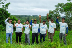
The Muyuna Floating Film Festival showcased a unique floating screen, bringing films directly to riverside communities in the Peruvian Amazon. During the festival, Rainforest Foundation US supported an Indigenous Cinema Workshop, emphasizing the urgent need to understand these issues from the perspective of Indigenous peoples and local communities.

Webinars

Right to the Land: Indigenous Land Title as a Climate Strategy

Here’s an insight at the heart of RFUS’s work: Lands legally controlled by Indigenous peoples and local communities show lower rates of deforestation—up to a 66% reduction in forest cover loss. Listen to Cameron Ellis and Kim Chaix of Rainforest Foundation US speak about the power of land titling.

Support Our Work

Rainforest Foundation US is tackling the major challenges of our day: deforestation, the climate crisis, and human rights violations. Your donation moves us one step closer to creating a more sustainable and just future.

THE EARTH IS SPEAKING​

Will you listen?

Now, through April 30th, your impact will be doubled. A generous donor has committed to matching all donations up to $15,000.

Any amount makes a difference.

Sign up today!

Get updates on our recent work and victories, stories from our Indigenous partners, and learn how you can get involved.

Didier Devers
Chief of Party – USAID Guatemala
gro.y1722065914nffr@1722065914sreve1722065914dd1722065914

Didier has been coordinating the USAID-funded B’atz project since joining Rainforest Foundation US in April 2022. He holds a Master’s in Applied Anthropology and a Bachelor’s in Geography. Before joining the organization, Didier worked for 12 years in Central and South America on issues of transparency, legality, governance, and managing stakeholders’ processes in the environmental sector. Prior to that he worked on similar issues in Central Africa. He speaks French, Spanish, and English, and is based in Guatemala.