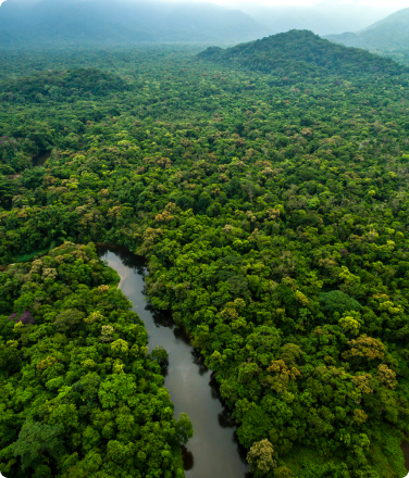
Indigenous Groups Unveil Plan to Protect 80% of the Amazon in Peru and Ecuador

Mongabay describes a plan for Amazon protection proposed by indigenous partners and supported by RFUS.
Want to Fight Climate Change Effectively? Here’s Where to Donate Your Money

For three years in a row, Vox has featured Rainforest Foundation US in an article that lists high-impact organizations addressing the climate crisis.
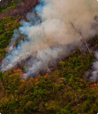
What is Deforestation–And is Stopping it Really Possible?

The Guardian explains the link between forests and global climate, and how indigenous communities halt deforestation, including the PNAS study backing satellite monitoring and alerts for forest loss.
Indigenous Amazon Communities Fight Deforestation with New Early-Alert Tool

Scientific American writes about the PNAS study supporting Rainforest Alert’s proven impact in Peru.
Climate Change: Technology Boosts Efforts to Curb Tree Loss in Amazon

BBC covers the study backing the success of Rainforest Alert, RFUS’s program that equips indigenous communities with technology to curb deforestation.
Peru’s Indigenous Tribes Use Tech Tools to Track Amazon Deforestation

Reuters highlights the study backing RFUS’s Rainforest Alert methodology, wherein indigenous communities use smartphones to map and send alerts of deforestation.
Profile in Forbes Gives a Face to the Amazon’s Front Line

An article in Forbes describes the work of indigenous leader Betty Rubio Padilla, who uses satellite technology and deforestation alerts in order to quickly detect and respond to illegal incursions.
Betty Rubio Padilla uses her cell phone to monitor the Amazon Rainforest for deforestation.
How One Man – And A Creative Map – Made A Difference In Panama’s COVID-19 Crisis

RFUS’s Mapping Coordinator, Carlos Doviaza, was featured in an NPR article that describes how his maps are helping indigenous communities in Panama assert their land rights and track COVID-19.
Indigenous Community Wins Recognition of its Land Rights in Panama

Mongabay writes about Panama’s Naso people, a Rainforest Foundation US partner, in their achievement of a protected indigenous territory following decades of effort.
Bridging Ancient Wisdom Into Modern Society

Forbes.com featured Rainforest Foundation as an example of celebrity-endorsed organizations doing effective work in support of indigenous peoples.